DESTINATION
Through well seasoned paths we discover pieces of history at every stepThis month you'll discover…
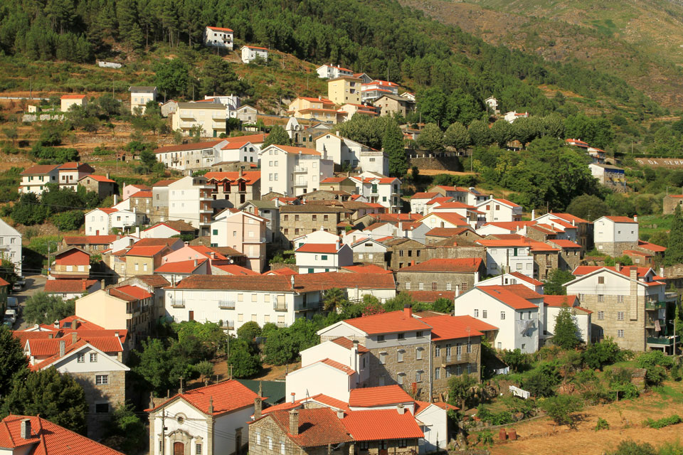
The Mountain Villages
Put on your boots, pack your backpack and get on your way. A Serra da Estrela is one of the perfect places to enjoy nature and nature Association of Integrated Development of the Mountain Villages Network tried to revitalize 15 routes that will allow you to discover a whole natural heritage, material and immaterial. Of course, passing through mountain villages is mandatory.
There are routes for all tastes: easy or difficult; more or less extensive; possible to perform at different times of the year. Ribeira do Piódão Route, Route of the Ribeira de Loriga, The Terraced Route, Eira Route, Loriga Gorge Route, Mass route, Canadas Route, Wolfram Route, Route of Minas do Círio, Caniça Route, Rossim Valley Route, Route of Fervença, Route of Ribeira de Alvoco, Grazing Route, Great Star Route. They are all marked along kilometers of mountains and fresh air. Take the opportunity to visit the villages of Sabugueiro, Póvoa Velha, Sazes da Beira,Teixeira, Loriga, Lapa dos Dinheiros, Head, Alvoco da Serra, Vide e Valezim.
You won't believe your eyes when you encounter some of the landscapes, with river beaches, waterfalls or simply with the distant horizon. They are paths full of emotion, good food, of unique traditions and parties that you won't want to miss. Yes, because in addition to contact with nature, these villages offer original events distributed over time that capture the experiences and warmth of a people that will welcome you with open arms.
You will feel in the clouds!

To follow our route, please subscribe our newsletter.

Pedro Ribeiro
Ribeira do Piódão Route
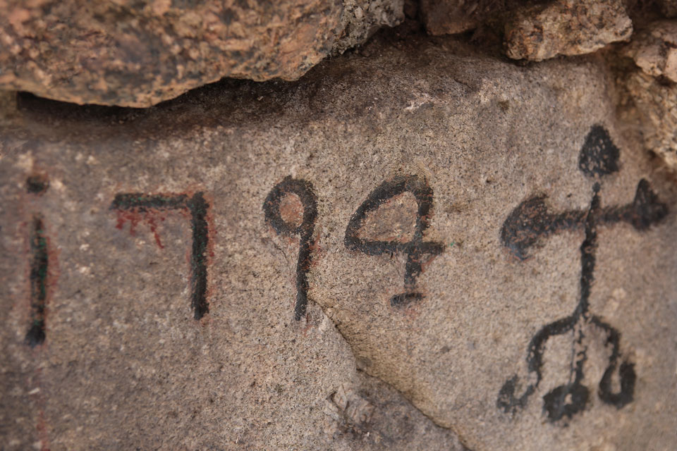
Empty is the seat of a parish composed of countless villages and places spread over a large area of territory and characterized by the ancient human presence dating from the Neolithic and Chalcolithic periods (there are many rock engravings that you can see). It is located next to Ribeira de Alvoco, in a huge valley surrounded by high mountains. Shale is abundant here, as you can see later. Vide stands out for the massive granite bridge that allows people and animals to pass between the two banks.
Although we started in a village near Ribeira do Alvoco, let's follow, throughout the journey, the flow of Ribeira do Piódão which gives its name to the circular path. Let's start and end the walk next to the Igreja Matriz de Vide, the Church of N. Sr da Assunção. Follow the signs and exit the village along the banks of the river, with its water mills and fertile agricultural fields in the surrounding. Pine forests and broom are also abundant in these places.
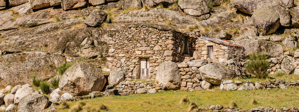
The way is easy, with few inclinations and that will allow you to enjoy, quietly, of the landscape. Take the opportunity to visit the villages of Rodeado and Coucedeira. These maintain the typical trait of mountain villages, with houses made of shale. Then just go back to the main church and keep this unique experience in mind.
Useful information
Recommended Season: all year Start of Course: Empty End of Course: EmptyDistance: 5,51 km
Difficulty: Easy
Approximate Duration: 2h Footpath Brochure: here

Jose Conde

Pedro Ribeiro
Route of the Ribeira de Loriga
Loriga is a village that lasted for centuries in the Serra da Estrela Natural Park, located between the Nave and São Bento rivers. The bridge and the sidewalk are evidence of the Roman occupation and even its name has its origins in medieval clothing. As in Lapa dos Dinheiros, this town is best known for its river beach and, just like all other mountain villages, has narrow streets and houses made, mainly, granite. It can be hard to imagine, but in the middle of the 19th century, there were more than 30 manufacturing units linked to the wool industry, fed by the abundant water that exists here. Loriga is characterized, currently, for its five chapels, cruises and fountains.
During the winter, the village is covered with a white blanket that wraps around the slopes and mountain peaks. However, in the summer, green takes center stage and wildlife, abundant in these parts, make yourself known. The surrounding agricultural fields, terraced, are irrigated by the glacial water that springs from dams and springs.
After leaving Loriga, one of the first things you’ll be able to observe are the geological phenomena known as Giant’s Lunchboxes, cavities that erosion carved into the mountain rocks. After, near the place of Sarapitel, you will find the first Poço de Broca, man-made canals that drained the fields and resulted in spectacular waterfalls.
The landscape is filled with woods, undergrowth and terraced agricultural fields. That's exactly why, near the village of Cabeça, this route crosses the Rota dos Socalcos.
We follow the route of the Ribeira de Loriga, but also, the levadas. This area is rich in water and it is channeled, across the mountain, to the fields through a channel. Pay particular attention if you don't handle heights well. The path can be dangerous. In Casal do Rei, will be close to the botanical reserve, a landscape that is well worth seeing. The next point of interest is the second Poço de Broca, near the village of Muro and near the point where we join the Rota da Ribeira do Alvoco until we reach the square of the parish church of Vide.
Useful information
Recommended Season: all year Start of Course: Loriga End of Course: EmptyDistance: 16,830 km
Difficulty: Difficult
Approximate Duration: 5.30 am Footpath Brochure: here

Pedro Ribeiro
Pedro Ribeiro
The Terraced Route
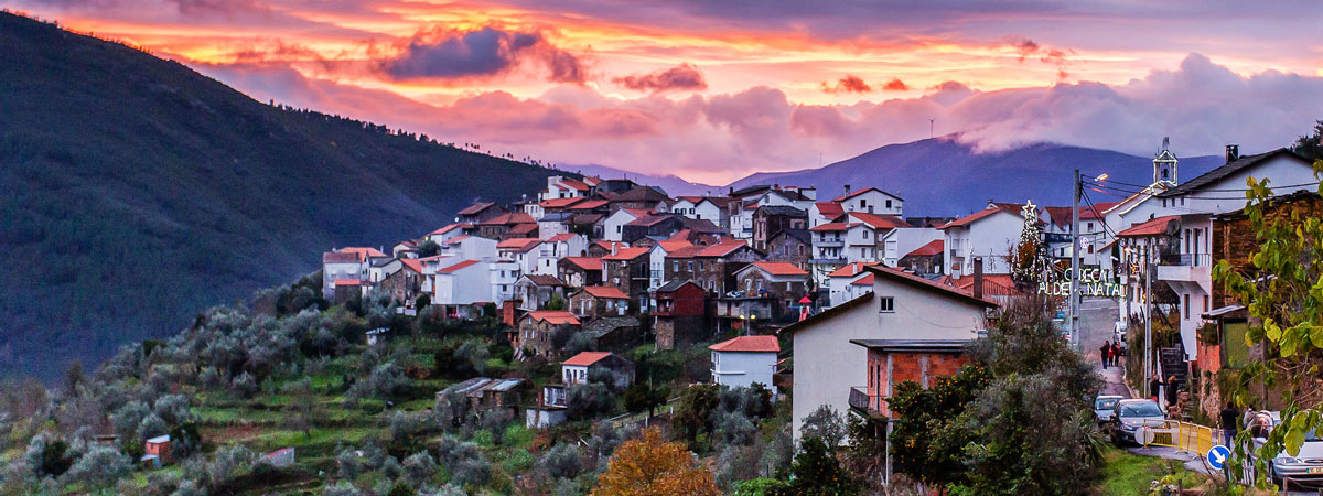
A village of Cabeça it can even be located on top of a granite bollard, in the middle of Serra da Estrela and far from the coast, here, cosmopolitan, however this was the first parish in Portugal to provide free internet access via wireless and, just let the night fall, so you can see that the whole village is lit by LED technology. It can be said that Cabeça combines tradition with a vision of the future.
The landscape dominated by the slope of the surrounding mountains and the valley. As casas, many of them built in shale stone and covered by slate, are arranged around the church of São Romão and divided by narrow streets typical of this region. The calm and peace that is breathed here is a sweet alternative to the hectic everyday life.
You can and should visit the village of Cabeça at any time of the year, but it is during the Christmas season that the streets come to life. The population comes together to decorate and organize the Head - Aldeia Natal. Taste the tasty regional delicacies and have fun together with this big family that is ready to welcome you(to).
Another suggestion is to make the walking route of the Rota dos Socalcos, whose beginning and end are next to the mother church of this village. It is a small (compared to others) and beautiful route through the terraced agricultural fields, the way the locals used to "tame" the rugged mountain terrain.
From the village of Cabeça, head towards Poço da Ponte, place where you will join the Ribeira de Loriga Route. Then you have to cross the Ponte das Vergas and start climbing, again, towards Head. Before the end you will still pass by the Porto Bridge, another one of the ex-libris of the village.
Useful information
Cabeça village events: Cabeça Aldeia Natal - 8 of December of 2016 to 6 th of January 2017 Recommended Season: all year Start of Course: Head End of Course: HeadDistance: 2,830 km
Difficulty: Easy
Approximate Duration: 1h45 Footpath Brochure: here

Ricardo Mendes
Pedro Ribeiro
Eira Route
We started the route in the village of Loriga, this time at Largo da Carreira. Hence, we continue clockwise towards the Ponte Nova sidewalk. In Loriga we highlight the presence of the ruins of the old wool factories that took advantage of the abundance of water and the strong demand for their products to grow. There were over thirty, in the middle of the 19th century. Today, are a spectrum of the importance that this location once had.
The path is short and relatively easy to travel. Delay, one, an hour and a half to complete the circuit. From Ponte Nova you will climb to Cabeço das Resteves from where you will get an incredible view under the surrounding landscape, in particular, terraced agricultural fields, chestnut groves and pine forests. Then go down, pass by Eira do Mendes, that gives the name to this route, pass by the place of Canadas and enter in the opposite direction of the Route of Ribeira de Loriga.
Finally, head back to Largo da Carreira and end the walk through the beautiful Serra da Estrela. If you still have time, we suggest you discover the unique flavors of Loriga or, if time permits, venture on the river beach of Loriga.
Useful information
Recommended Season: all year Start of Course: Loriga End of Course: Loriga Distance:2,870 kmDifficulty: Easy
Approximate Duration: 1.30 am Footpath Brochure: here

Pedro Ribeiro
Pedro Ribeiro
Loriga Gorge Route
Don't be fooled because the path is always going down. The route is difficult and not recommended when the weather is adverse or when you do not have adequate equipment such as warm clothing or mountain boots. The route will be ideal between May and October.
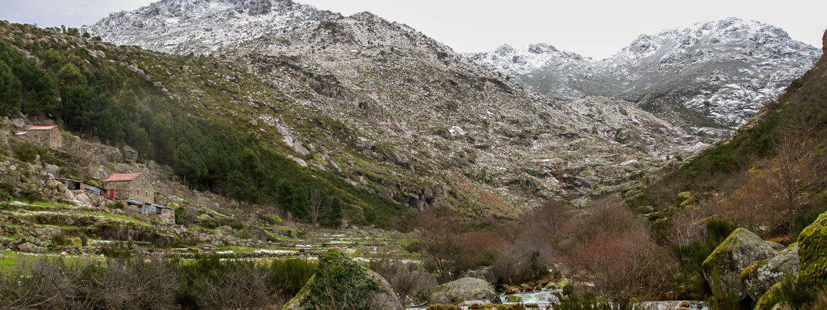
We started the adventure in Salts, an upper plateau of Serra da Estrela. The landscape is unique and breathtaking. Silence is absolutely magical. Glacier remains can be observed along the entire route. The first noteworthy landmarks are depressions known as creos. The first is Covão do Boieiro, then you will pass through Covão do Meio, characterized by the magnificent reservoir, then Covão da Nave and, and, Covão da Areia.
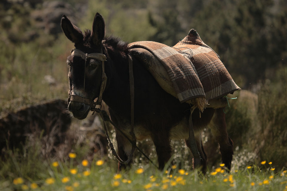
After crossing Ribeira da Talada go to Eira da Pedra. Sometimes the Route uses paths long used by shepherds and their flocks during transhumance. Transhumance is the name given to the movement of herds to fertile land when spring arrives and their return to villages located in the lowest quotas when winter weather begins to threaten. Shepherds spent long months away from home tending their flocks. Sometimes, we find traces of this cultural phenomenon in the ruins of isolated houses on the mountain.
It's almost over. The path can be difficult, but it is rewarding. The place of arrival is Largo da Carreira, in the village of Loriga. Take the opportunity to recover your energy in this beautiful location.
Useful information
Recommended Season: May to October Start of Course: Salts End of Course: Loriga Distance: 8,770 kmDifficulty: Difficult
Approximate Duration: 3.30 am Footpath Brochure: here

Pedro Ribeiro

Jose Conde
Mass route
The route follows an old rural path that connected the villages belonging to the Teixeira river valley. It is called the Route of the Mass because this path was used by the faithful to attend the Sunday Mass that was held in the chapel of N. Ms. Incarnation, in Teixeira. Nowadays, the means of communication, the means of transport and the decrease in the number of people coming to the chapel made the path obsolete, however, fortunately, this became a beautiful path for a pedestrian walk.
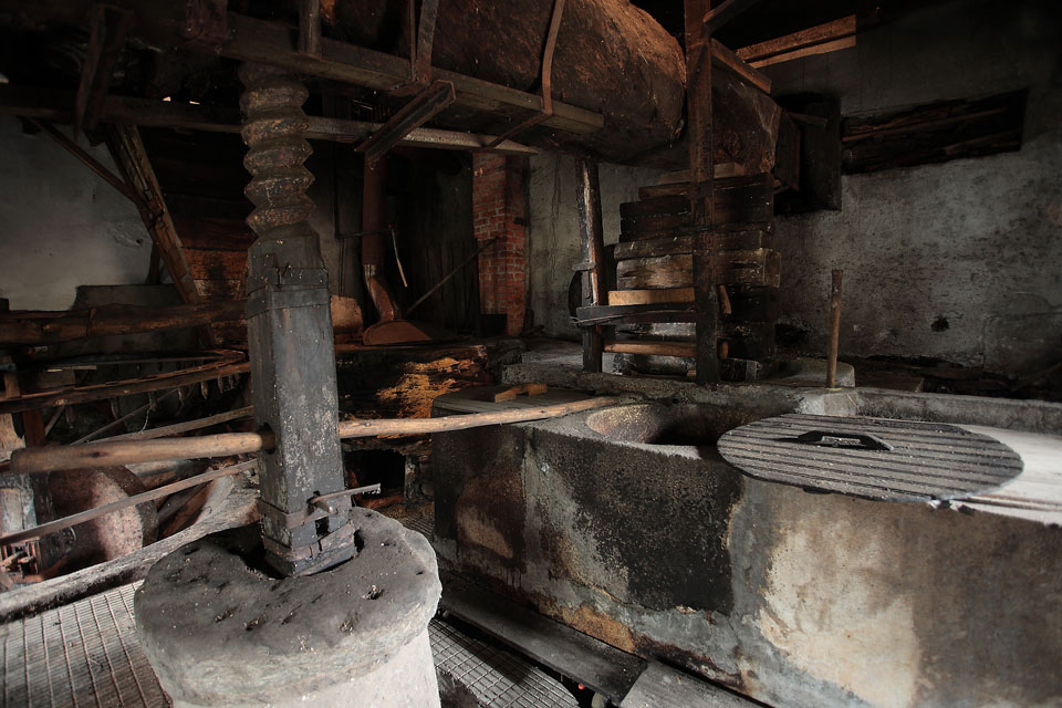
We started in Teixeira, one of the villages in the parish, which still houses several old buildings constructed in schist and slate. Before starting the path, can (and must) visit the olive oil press mill and the various stills producing arbutus brandy, one of the characteristic products of the village.
Let's take the opposite route to what people used to do in the past. We start next to the Chapel of N. Ms. Incarnation and we advance through a rugged landscape, through maritime pine forests and gorse. Around us terraced agricultural fields continue to provide sustenance for many families. Occasionally clusters of arbutus trees appear from which the arbutus trees are removed to make the brandy. Water is a constant, we were not following the current of Ribeira de Teixeira, tributary of the Ribeira de Alvoco.
The tour ends at Broca do Aguincho Well, a waterfall that emerged after the river's course was altered to create farmland. Nearby there are several tanks where trout grow for commercialization and local consumption. If possible you can go there to kill hunger after the walk, Or until, fish for trout for dinner.
Useful information
Recommended Season: Every year Start of Course: Teixeira End of Course: Aguincho drill pit Distance: 5,10 kmDifficulty: Easy
Approximate Duration: 2h Footpath Brochure: here
Jose Conde

Pedro Ribeiro
Canadas Route
The thick fog allows us to glimpse the harbinger of a magical place, with stunning natural beauty. It is at the head of the valley of riverside of Alvoco that you can find this village that is thought to be before the Roman times.
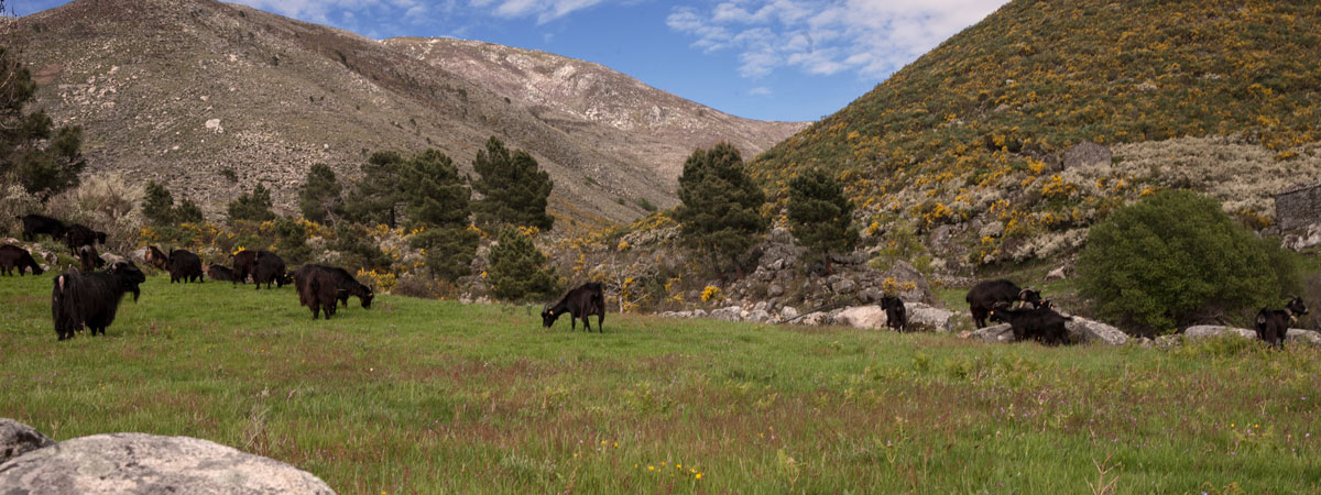
The clear, cold water of the stream that gives the village its name, runs quickly under the Roman-medieval bridge. Here, livestock farming still exists, especially goats and sheep and the cultivation of the surrounding fields. The houses are made of granite but are then plastered and painted white. There is still a community oven and the 19th century Eira. century.
Alvoco da Serra it was already an important pole in this region having hosted three wool factories simultaneously. It became the county seat, but now the seat of a parish composed of 5 mountain villages.
There are many reasons to visit Alvoco da Serra, but why not take advantage of events that bring people together and promote socializing? The Solstice Festival and the Lampião Walk are events you won't want to miss. The Lampião Walk is an evening walk, lit only by the light of the lamps, in an allusion to the time when crops were watered at night. July, you can also participate in the Malha do Rente that will transport you to the experiences of the villages in the interior.
This is a circular route that starts and ends at the Chapel of St. Anthony, home of the Sacred Art Museum. Ribeira do Alvoco is behind, but there are many more streams along the way. Water is a constant, which explains the existence of a large number of water mills that were used to produce flours. See, all around, granitic outcrops and agricultural fields, as well as gestais and heaths. The route stretches along walled paths designated by "Canadas", they are the ones who baptized this layout. Halfway through, we ended up joining the Grazing Route until we reached the end of this adventure, again next to the Chapel of St. Anthony.
Useful information
Events in Alvoco da Serra:Solstice and Lampião Walk Festival - 16 and 17 st of June 2017 Rye Mesh Party - 14 nd of July 2017 Recommended Season: Every year Start of Course: Alvoco da Serra End of Course: Alvoco da Serra Distance: 6,16 kmDifficulty: Something difficult
Approximate Duration: 2h Footpath Brochure: here
Pedro Ribeiro

Pedro Ribeiro
Wolfram Route
It's broken, alongside the Minas do Círio Route, is dedicated to the exploration of ores that occurred in this region and whose contribution to the local and national economy was very important. And, as in Minas do Círio, these mines have been explored, especially, during World War II. Along the way you will find several entrances to the galleries that used to be part of the old Minas Couto Malha Malha (or Malhão). Mines were an important source of livelihood for the people of Sazes da Beira.
We started the tour at the Santa Eufémia Shrine, a small temple overlooking the village. From there we walk the labyrinthine streets, whose old urban core is composed, mainly, for houses built in shale and slate, abundant material in the saw.
The path runs through the space surrounding the village of Sazes da Beira, rich in terraced agricultural fields, hydraulic mills and maritime pine pine forests. Close here, in Aaron's window, Forest Services created, during the decade 1960, a tree nursery for the reforestation of Serra da Estrela.
Halfway through, we joined the banks of the Ribeira de Sazes, in a landscape also marked by brushwood and gorse, and that accompany us until we arrive, again, to the Santa Eufémia Sanctuary where we say goodbye to the village of Sazes da Beira.
Useful information
Recommended Season: Every year Start of Course: Sazes da Beira End of Course: Sazes da Beira Distance: 4,170 kmDifficulty: Easy
Approximate Duration: 2h Footpath Brochure: here
Jose Conde

Pedro Ribeiro
Route of Minas do Círio
This route will provide you with the opportunity to discover an area influenced by mineral extraction, the Minas do Círio Route. The paths extend in the vicinity of the village of Valezim, an old town originating from the reconquest of Portuguese territory from the Moorish army.
From the traditional village, the chapel of São Domingos stands out, the pillory, the Church of N. Srª. do Rosário and the Castelo Branco Manor.
The trail starts at the pools, on municipal road nº 231. Then we went around Valezim, passing by the 16th century fountain and following the terraced agricultural fields towards Dornelas. After crossing the stream, you will begin to descend towards the mines.
Círio mines are a former mining complex for tin and tungsten extraction that peaked during World War II. Due to the risk they pose, you should not try to enter the galleries. It is best to start the way back, the same for which it arrived.
After Dornelas and after crossing the river again, the path will take you to Poço da Laje and Ribeira de Valezim. Depending on the time of year, the sound of the water is a constant, not only here but for a large part of the route. The mills used this strength to grind the grains that fed the surrounding villages. This is a route that will make you feel in the past. worth it.
Useful information
Recommended Season: Every year Start of Course: EN 231 End of Course: EN 231 Distance: 7,10 kmDifficulty: Something difficult
Approximate Duration: 2.30 am Footpath Brochure: here

Jose Conde

Pedro Ribeiro
Caniça Route
The village of Lapa dos Dinheiros he is, most likely, best known for its river beach created in Ribeira da Caniça, in full communion with nature. If it's good weather (and hot, preferably), take the opportunity to bathe in the crystal clear waters. On the river beach you can follow the pedestrian path to Buraco da Moura, a natural cave system, or even to the viewpoint overlooking the waterfalls.
Lapa dos Dinheiros is home, also, of a chestnut grove, dense and verdant, called Bosque da Lapa. This is where, the Bosque Music Festival is held, an original and unique music festival in the country, a great reason to visit this region.
Access to the village is made by climbing the mountain slope. The narrow streets, almost all sidewalk, and the friendliness of the villagers, encourage a walking tour. The landscape extends for kilometers over the valley and the Mondego platform. Its proximity to the city of Seia and, consequently, its services and amenities is an asset that makes Lapa dos Dinheiros an ideal destination for those who want to enjoy contact with nature.
If that's your case, take the time to do the Caniça Route. This route goes through the most important points of interest in the area evolving to Lapa dos Dinheiros such as the river beach, the centenary oaks, the Caniça Falls, the Sumo Hole or the Devil's Horns. Ribeira da Caniça is rich in fauna and fauna that you can observe depending on the time of year when you decide to venture into these places. One thing is right, you will not regret.
Useful information
Events: Bosque Music Festival - 23, 24 and 25 st of June 2017 Recommended Season: Every year Start of Course: Lapa dos Dinheiros End of Course: Lapa dos Dinheiros Distance: 6,966 kmDifficulty: Something difficult
Approximate Duration: 2h45 Footpath Brochure: here

Jose Conde

Jose Conde
Rossim Valley Route
In 1956 the Vale do Rossim dam started operating, creating a barrier in Ribeira de Fervença and, consequently, flooding the surrounding lands. This event ended up creating that, what is considered, the highest beach in Portugal, in the heart of the Serra da Estrela Natural Park. It is certainly, one of the most beautiful and with an adequate support center. Hotel units, a campsite and a cafe are some of the perks you can enjoy.
The journey starts here, next to the cafe and the reservoir created by the dam. The route follows old paths to the Sabugueiro, paths once used by pastors, coal and farmers, but who, currently, are visited by tourists who appreciate contact with nature. While on spring or summer days the obstacles and the slope can be overcome with some ease, we call your attention to take special care in cold seasons as the weather conditions can change suddenly and leave you in a difficult situation.
All the way you will be able to observe scrubland of gorse and sargasso and other mountain species, birds of prey circle the skies in search of the next prey on a silent flight. The granitic outcrops sprout from the mountain forming natural sculptures of an odd beauty.
Close to the village of Sabugueiro you will find the Cascade of Fervença and the bridge of Porto Cabrito. The tour ends at the Igreja Matriz do Sabugueiro, proudly considered the highest village in the country.
Useful information
Recommended Season: Every year Start of Course: Rossim Valley End of Course: Sabugueiro Distance: 6,345 kmDifficulty: Something difficult
Approximate Duration: 3h Footpath Brochure: here
Jose Conde
Pedro Ribeiro
Route of Fervença
On the national road, before reaching the Sabugueiro, there is an indication that says “Welcome to Sabugueiro, Highest village in Portugal (1050m)". This village, of typically serrano line, with its granite houses, is still closely linked with pastoralism and community life. Around, rye crops remain, whose grain is used to make bread, cooked, sometimes, in the community oven, still in use. Sheep's milk is also produced here, which is then used to make the famous Serra da Estrela cheese.
This link to traditions is very evident in the events that Sabugueiro hosts throughout the year. The 25 of February happens the Queima do Entrudo. A 1 July the village joins the Festival of Transhumance and Pastors in a tribute to one who is one of the most illustrious representatives of mountain life, the pastor. And then there's Caçoilas Night, to 4 November. Once, on weddings and other village parties, made in homes, the kid, the chanfana or the lamb, seasoned in clay pots that were then taken to the community oven to bake. It is a true festival of flavors that you have to discover.
Whatever the time of year you choose to visit Sabugueiro, you should take the Rota da Fervença which draws a circuit around the village crossed by Ribeira do Covão and Ribeira da Fervença.
The path starts next to the Igreja Matriz and goes to Ponte da Serra. The path is circular and of reduced difficulty. The landscape is punctuated predominantly by pine forests, lameiros (land used to produce pasture), heather scrub and broom. We also highlight the magnificent waterfall of Fervença whose noise of the waters will fill you with energy for the final meters.
Useful information
Events: Burning of the Entrudo - 25 of February of 2017Feast of Transhumance and Pastors - 1 nd of July 2017
Caçoilas Night - 4 of November of 2017 Recommended Season: Every year Start of Course: Sabugueiro End of Course: Sabugueiro Distance: 4,740 km
Difficulty: Easy
Approximate Duration: 2.30 am Footpath Brochure: here

Pedro Ribeiro

Jose Conde
Ribeira do Alvoco Route
Serra da Serra is filled with small villages scattered over its hills and valleys. This long route, that takes more than six hours, makes the connection between Alvoco da Serra and Empty, by an old path that runs through a well-defined valley.
The route is difficult with, an optional detour if you want to visit the beautiful village of Vasco Esteves de Cima, a temple to silence. Then return to Ribeira de Alvoco and follow your bed. You will pass through a landscape dominated by pine forests, bush and agricultural land, source of livelihood for the surrounding populations. To irrigate these fields,, to take the water there and even the course of the stream was deviated to drain land and open new places for crops. The deviations led to several wells, cascades of crystal clear water that echo in the air. You will pass hydraulic mills that transformed the grain into flour that was later used in the production of bread for the community.
This is a long journey that must be made with time and care at the highest points or the narrowest paths. Nature swallows us up in a warm embrace and we almost lose ourselves in forgetting memory. It can be a long journey, but keep it well worth it when you arrive, at last, near the Igreja Matriz de Vide.
Useful information
Recommended Season: Every year Start of Course: Alvoco da Serra End of Course: Empty Distance: 17,095 km + 4,760 km (derivation of Vasco Esteves de Cima)Difficulty: Difficult
Approximate Duration: 6.30 am Footpath Brochure: here
Jose Conde
Jose Conde
Grazing Route
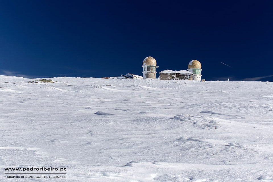
We are in one of the most emblematic places of Serra da Estrela: in Torre, the highest point in the mountains and in mainland Portugal, 1993m. Hence, on days when conditions are ideal, you can see yourself to the sea, in the Figueira da Foz area. The temperatures can be quite low and the snow very high so it is advisable to do this route at times when there is not a thing, nor another. However, even in summer, come forewarned. The mountain climate can play tricks.
Who knows the secrets of the mountain are the shepherds, that since time immemorial, transhumance with their herds in search of green pastures that cover mountain meadows amid rock outcrops.
The Route follows ancient paths used by pastors, through the southern slope of the upper massif, which provides a magnificent view over the center region. Although the slope is always going down, the path to the village of Alvoco da Serra is difficult and time consuming. It is practically three and a half hours of walking through a breathtaking landscape. The silence that is felt is, only interrupted by the sound of birds' wings or the force of water making its way through the rocks.
Before Alvoco da Serra you will still cross Ribeira do Meio and Ribeira das Forjas. The terraced fields are a constant as they continue to be a source of livelihood for the populations.
In the end you can restore the forces (and chase away the cold) discovering the delicious flavors of the mountains.
Useful information
Recommended Season: May to October Start of Course: Torre End of Course: Alvoco da Serra Distance: 7,780 kmDifficulty: Difficult
Approximate Duration: 3.30 am Footpath Brochure: here
Pedro Ribeiro